Circular Hike Around Lake Glattalp
Glattalp is a true natural paradise and the starting point for numerous hikes. In this hiking guide, you’ll learn more about the circular hike around Lake Glattalp. The walk around the lake takes approximately 2 hours and covers a distance of around 8.5 kilometres.
The Glattalp circular trail is mostly flat, making it suitable even for less experienced hikers or people with lower fitness levels.
In our photo gallery, you’ll find additional images from the hike, while our video gallery includes short videos and impressions from Glattalp.
Useful Information About the Glattalp Lake Hike
Experience the Glattalp Hike in Our 30-Second Video
Below, you’ll find more information about the circular hike around Lake Glattalp in our hiking guide. Not in the mood to read? Then check out more videos about Glattalp and the circular hike, or visit our photo gallery.
Was dich im Reisebericht zur Glattalp erwartet:
- Wie du auf die Glattalp gelangst
- Von der Bergstation zum Glattalpsee
- Wie der Pegel des Sees deine Wanderroute am Glattalpsee beeinflusst
- Letztes Viertel auf dem Südufer Wanderweg
- Zurück zur Bergstation Glattalp
How to Reach Glattalp by Cable Car
You can reach Glattalp either by completing a 2-hour hike with around 700 metres of elevation gain, or by taking the cable car from Sahli valley station. If you’d prefer to avoid the sweaty uphill climb, the Glattalp cable car offers a much easier alternative and brings you to the impressive alpine plateau in around 15 minutes.
Important: Expect Waiting Times
Since the cable car has a very limited transport capacity, long waiting times can occur, especially during busy periods. For the descent back to the valley, waiting times of one to one and a half hours are not uncommon.
Because of this, it may be worth considering hiking back down instead of taking the cable car.
Important Note About Operating Information
Based on personal experience, I know that information on the official Glattalp cable car website isn’t always fully up to date. There have been occasions where the website indicated that the cable car was operating, only for us to discover on arrival that it wasn’t.
A quick phone call beforehand can help avoid disappointment. Phone: +41 41 819 49 94
Arriving by Public Transport
Muotathal, located in the heart of Central Switzerland, can easily be reached by public transport. From Schwyz railway station, take Bus No. 501 operated by Auto AG Schwyz towards Muotathal.
Between Muotathal Post and Sahli / Glattalp cable car valley station, the small Bus No. 506 operates.
Useful Information About the Glattalp Cable Car
From the Mountain Station to Lake Glattalp

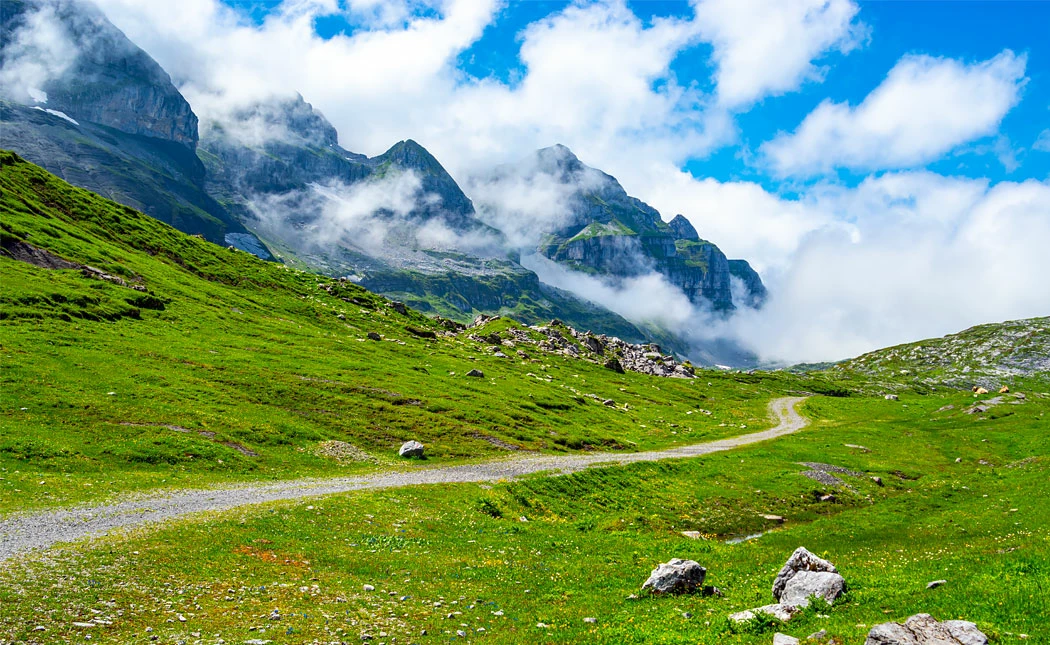

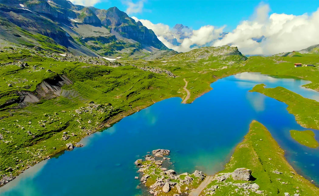
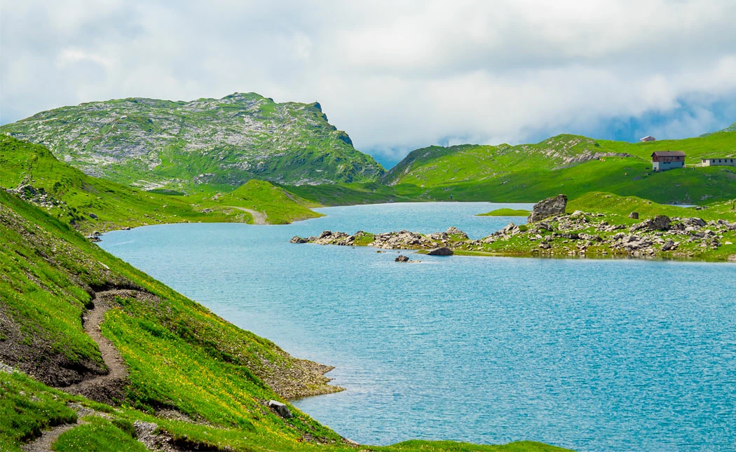
The two-hour circular hike around Lake Glattalp begins at the Glattalp mountain station. From the cable car station, you’ll reach Lake Glattalp after around 30 minutes and roughly two kilometres on a well-maintained gravel path.
Even this first section of the hike rewards you with breathtaking views of the Schwyz and Glarus Alps. You’ll also catch your first glimpse of peaks such as Höch Turm, Ortstock and Schijen.
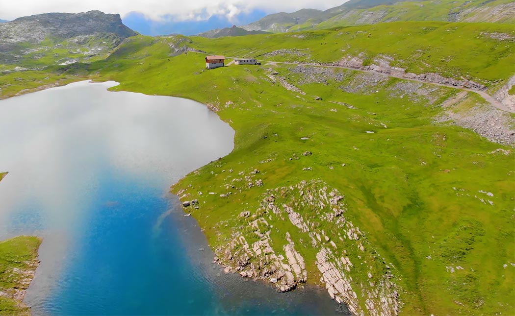
The hiking trail passes the Glattalp mountain inn, before reaching a junction where you need to choose between the southern or northern lakeside trail. Since this is a circular hike, the direction you choose doesn’t really matter. On our hike, we opted for the southern route. If you choose this option, simply continue straight ahead along the gravel path.
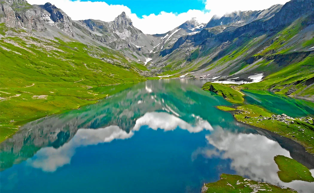
After a short walk, you’ll arrive at the sky-blue Lake Glattalp, surrounded by an extraordinary alpine panorama. Around the lakeshore, you’ll find several places to sit and rest, ideal for a picnic or enjoying a coffee or tea while taking in the scenery.
This picturesque mountain landscape alone is worth the journey and captivates visitors with its impressive beauty. Throughout my travels and hikes, both in Switzerland and abroad, I’ve experienced many beautiful places.
Yet the view across Lake Glattalp with its overwhelming mountain backdrop still makes my heart beat a little faster every time.
I could easily sit here for hours and simply absorb the atmosphere.
After a short break and a few moments of admiration, the next section of the Glattalp circular hike begins.
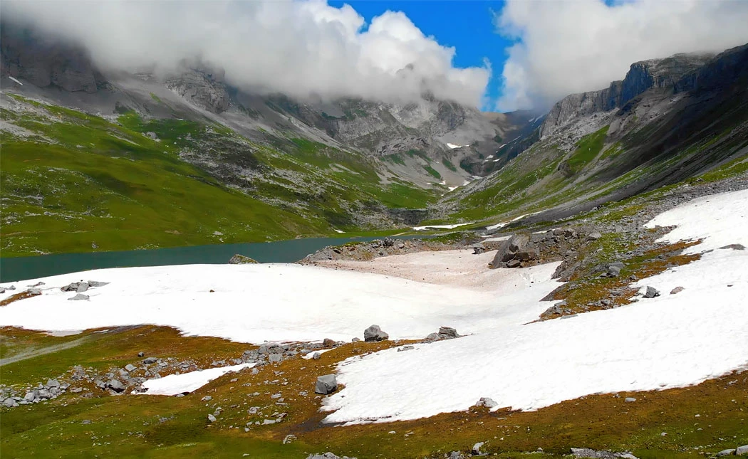
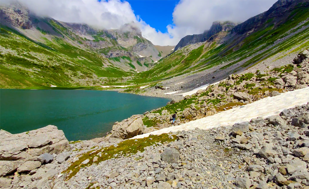
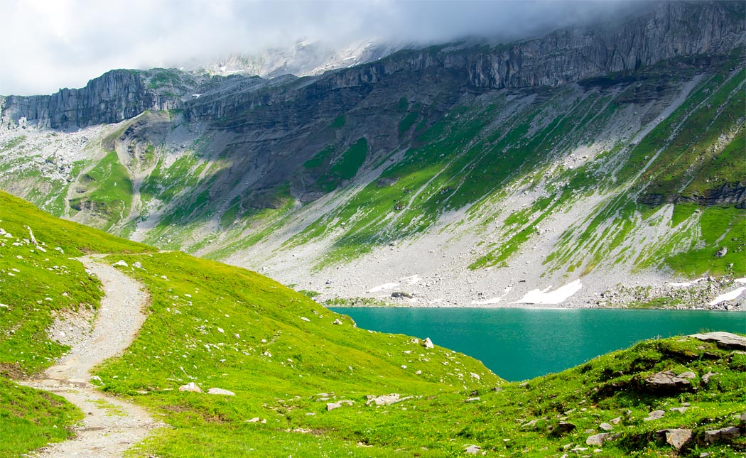
The Water Level Determines the Hiking Route Around Lake Glattalp

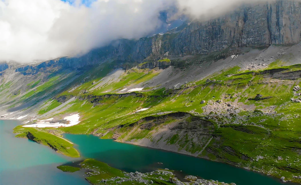
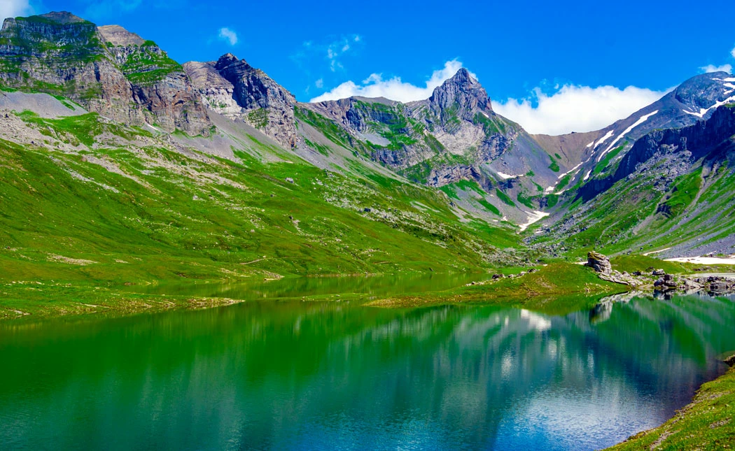
The route of the middle section of the Lake Glattalp circular hike depends largely on the water level of the lake. When water levels are low, Lake Glattalp is divided into two sections by a rocky ridge.
The hiking trail then follows this natural stone barrier, allowing you to continue directly along the lakeshore. However, during periods of high water levels, the rocky ridge and gravel path become completely submerged.
In this case, the hiking route continues closer to the shore and over uneven terrain, requiring you to cross rocks and rougher ground. While this alternative route is slightly more demanding, it also offers different perspectives of the lake and surrounding mountain scenery.
Depending on the conditions, the same circular hike can therefore feel surprisingly different from one visit to another.
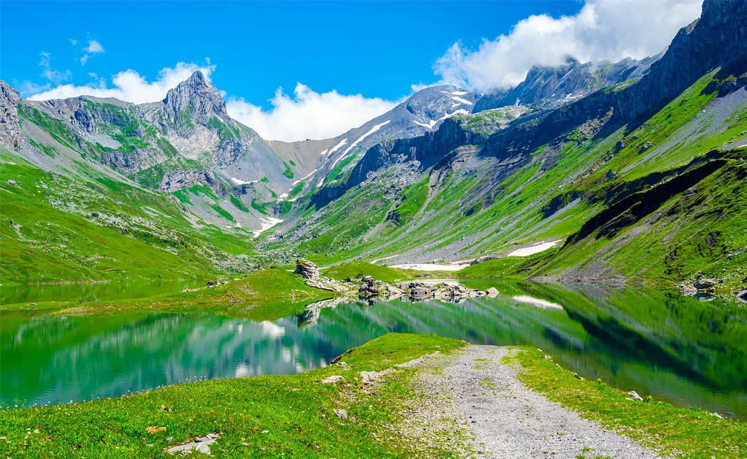
Final Section Along the Southern Shore Hiking Trail
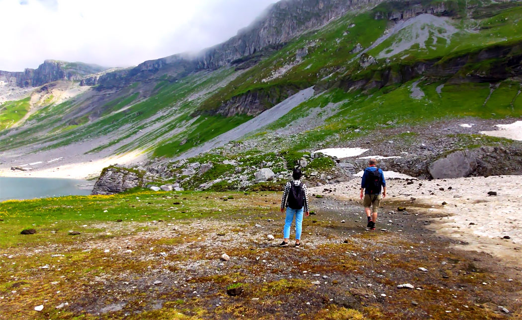
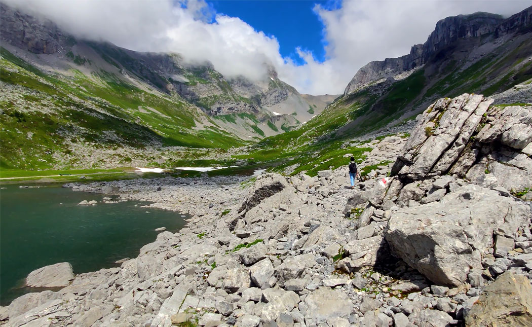


The final quarter of the circular hike follows the southern shoreline of Lake Glattalp. This section of the trail inevitably leads over rocks and uneven terrain, regardless of the lake’s water level.
However, the rocks along this part of the route are noticeably larger and slightly more challenging to navigate. Even in mid-summer, you may still encounter remaining snowfields, which occasionally need to be crossed.
Overall, this is the most demanding section of the Lake Glattalp circular hike. That said, the route does not pose any major difficulties and can generally be completed without much trouble, even by less experienced hikers.
At the end of this section, you’ll reach the eastern end of Lake Glattalp. Here, a bridge crosses the Glattalp stream, which feeds the lake basin with meltwater flowing down from the surrounding mountain peaks.
Once you’ve crossed the bridge, the return section of the circular hike begins.
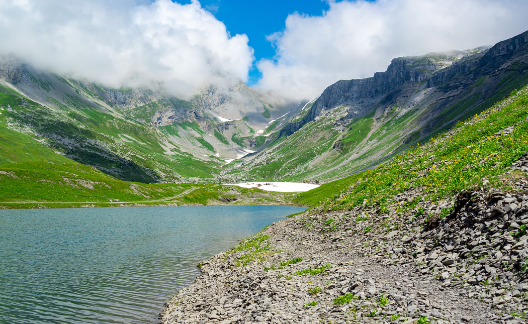
Return to the Glattalp Mountain Station

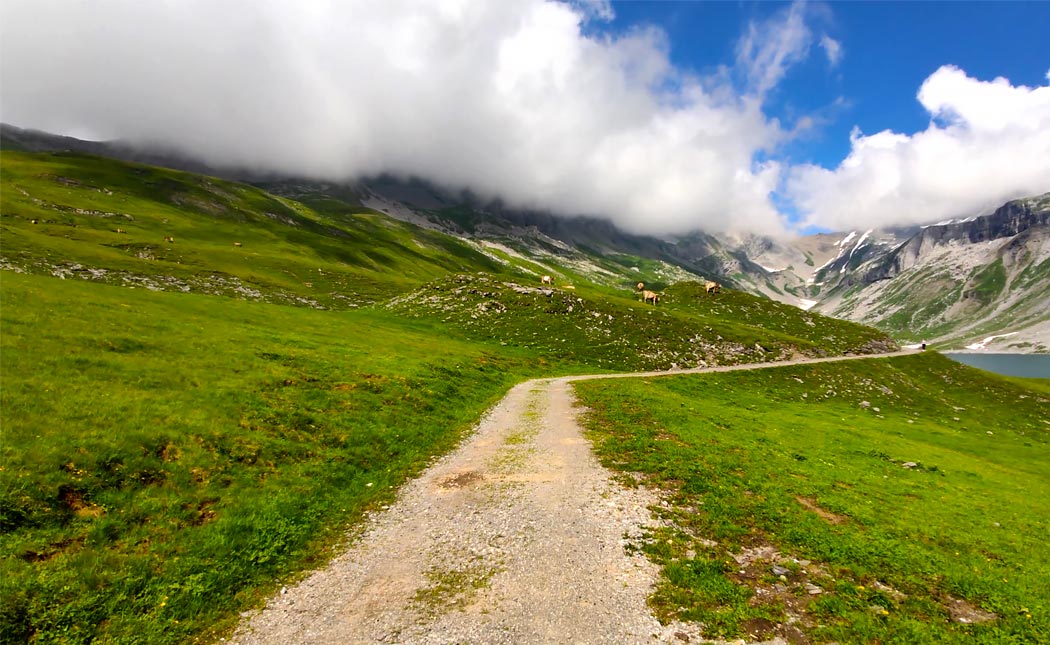


After completing the southern shoreline section of Lake Glattalp, the northern lakeside trail leads you back towards the starting point at Glattalp mountain station.
The return route follows a well-maintained gravel path, making this part of the hike easy to walk and free from major challenges. Along this final section of the Glattalp circular hike, a new mountain panorama opens up towards the west.
Here, you’ll enjoy views of peaks such as Alpler Horn, Torstock and the Windgällen mountain range, adding another impressive perspective to the already spectacular scenery. The return walk takes a little over one hour, before eventually bringing you back to the Glattalp cable car mountain station.
From here, you can decide whether to take the cable car back down to the valley or continue on foot to the valley station.
Do You Have Questions About the Glattalp Hiking Guide?
Are you planning a hike around Lake Glattalp and still have questions about the route?
Or do you know other hiking trails around Glattalp that you’d like to share with our readers?
Then simply use the contact form below to get in touch.