Golzernsee – Hiking Route With Stunning Mountain Scenery
Lake Golzern in the canton of Uri impresses with its picturesque alpine panorama and is an excellent starting point for several beautiful mountain hikes.
In this hiking guide, I’ll introduce you to a scenic hiking route through this spectacular mountain landscape. The hike starts at Bristen valley station and leads via Lake Golzern to Windgällen Hut.
From there, the trail continues across an alpine plateau, before descending towards Hotel Maderanertal. The final section returns to the starting point at Bristen valley station, completing a rewarding circular hike through the Uri Alps.
You’ll find more photos from the Golzernsee hike in our photo gallery, definitely worth a look.
You can also discover videos featuring the Swiss Alps in our video gallery.
Useful Information About the Golzernsee Hike
Experience the Golzernsee Hike in Our 30-Second Video
Below, you’ll find more information about the Golzernsee hike and the hiking route in our detailed hiking guide. Not in the mood to read? Then check out more videos about Lake Golzern and the circular hike, or visit our photo gallery.
Was dich im Reisebericht zur Golzernsee Wanderung erwartet:
- Wie du zum Golzernsee gelangst
- Der Golzernsee im Detail
- Vom Golzernsee zur Windgällenhütte
- Von der Windgällenhütte zum Hotel Manderanertal
- Manderanertal zurück zur Talstation Bristen
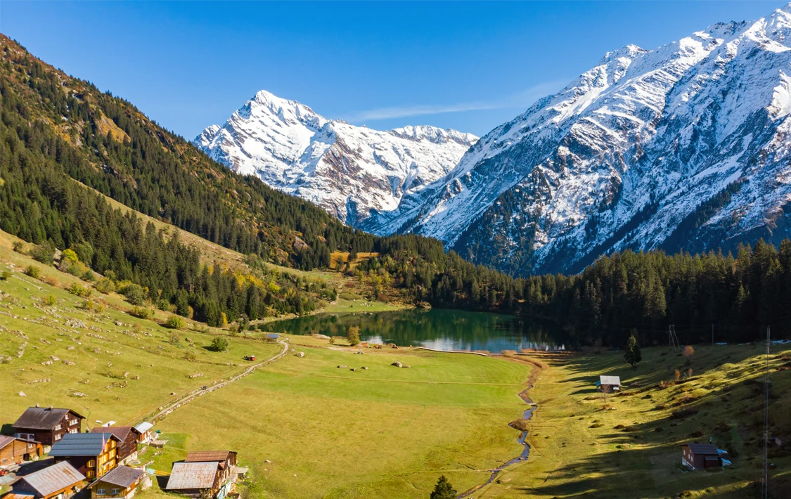
The starting point for this hiking route to Lake Golzern is the valley station in Bristen. From here, you can take the LSB cable car, which operates approximately every 30 minutes.
The relatively small cabins accommodate up to 8 people, while the journey to the mountain station takes around 10 minutes. A one-way ticket costs CHF 11, while a return ticket is available for CHF 17.
If you arrive by car, you’ll benefit from around 450 free parking spaces directly at the valley station.
Alternatively, you can follow the hiking trail leading up to Lake Golzern.
This route covers approximately 520 metres of elevation gain and takes around 2 hours to complete. The hiking trail is well signposted from the valley station.
From the mountain station, Lake Golzern can be reached within 20 to 30 minutes on a well-maintained gravel path. Along the way, local mountain farmers sell crystals and handmade wood carvings at fair prices.
The trail also passes through two small alpine villages with charming wooden houses, adding to the authentic mountain atmosphere. Shortly before reaching the lake, you’ll come across a small mountain chapel, which is worth a quick visit.
For refreshments, you’ll find two dining options nearby: Gasthaus Edelweiss and Restaurant Golzernsee.
Useful Information About the Cable Car to Lake Golzern
Lake Golzern – Crystal-Clear Alpine Lake With Stunning Mountain Views
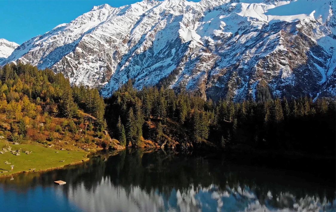


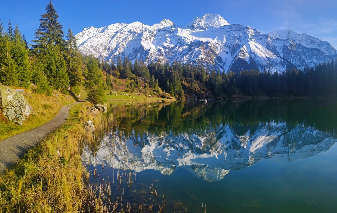

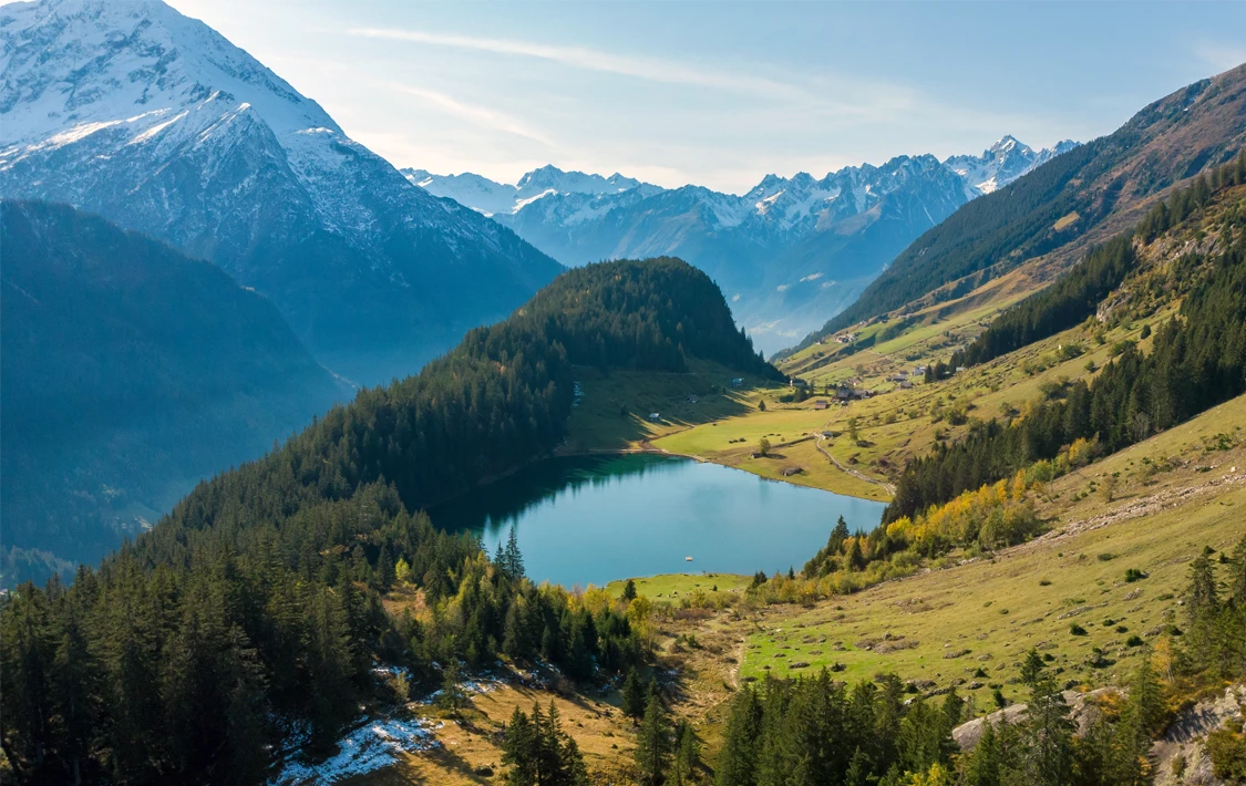
Lake Golzern is particularly beautiful during autumn, when the surrounding landscape is covered in golden colours and the snow-capped mountain peaks reflect in the deep blue, crystal-clear water.
It’s therefore no surprise that Lake Golzern has become a popular swimming lake, thanks to its spectacular alpine scenery. During the summer months, the water temperature often reaches up to 20°C, offering a refreshing escape for hikers, swimmers and sunseekers alike.
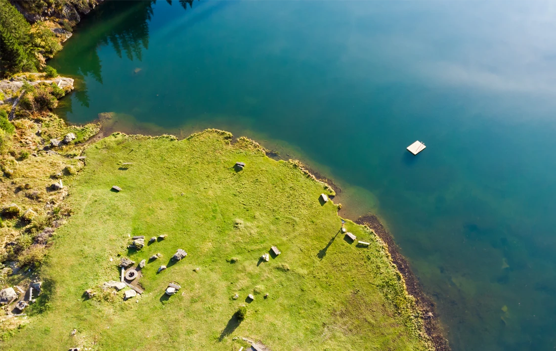
The shallow water makes swimming pleasant, while the surrounding panorama invites you to simply pause and enjoy the peaceful atmosphere. Along the north-eastern shoreline, you’ll find barbecue areas, wooden seating and sunbathing spots, as well as a floating platform on the lake.
If your motivation for hiking starts to fade, this is the perfect place to slow down, relax and soak up the mountain scenery. Or simply enjoy the sun and take a few refreshing swims in the lake.
Fishing enthusiasts can fish in Lake Golzern between 1 June and 30 September. However, a fishing permit issued by the canton of Uri is required.
From Lake Golzern, the hiking trail continues towards Windgällen Hut, where the next section of the route
Hike From Lake Golzern to Windgällen Hut
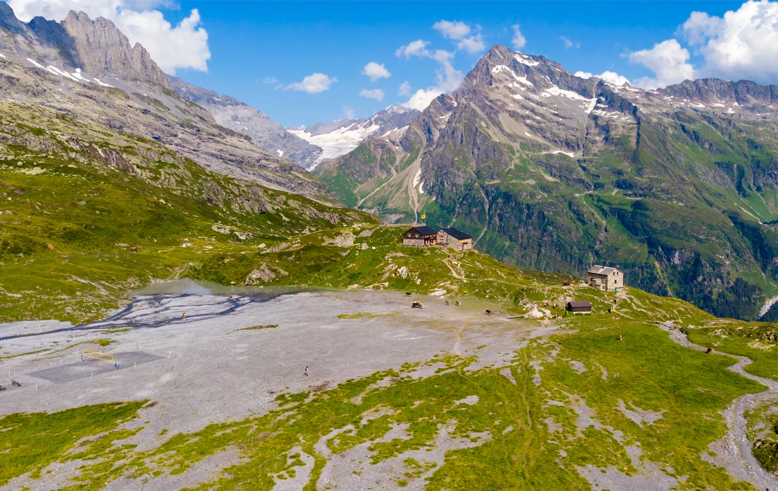

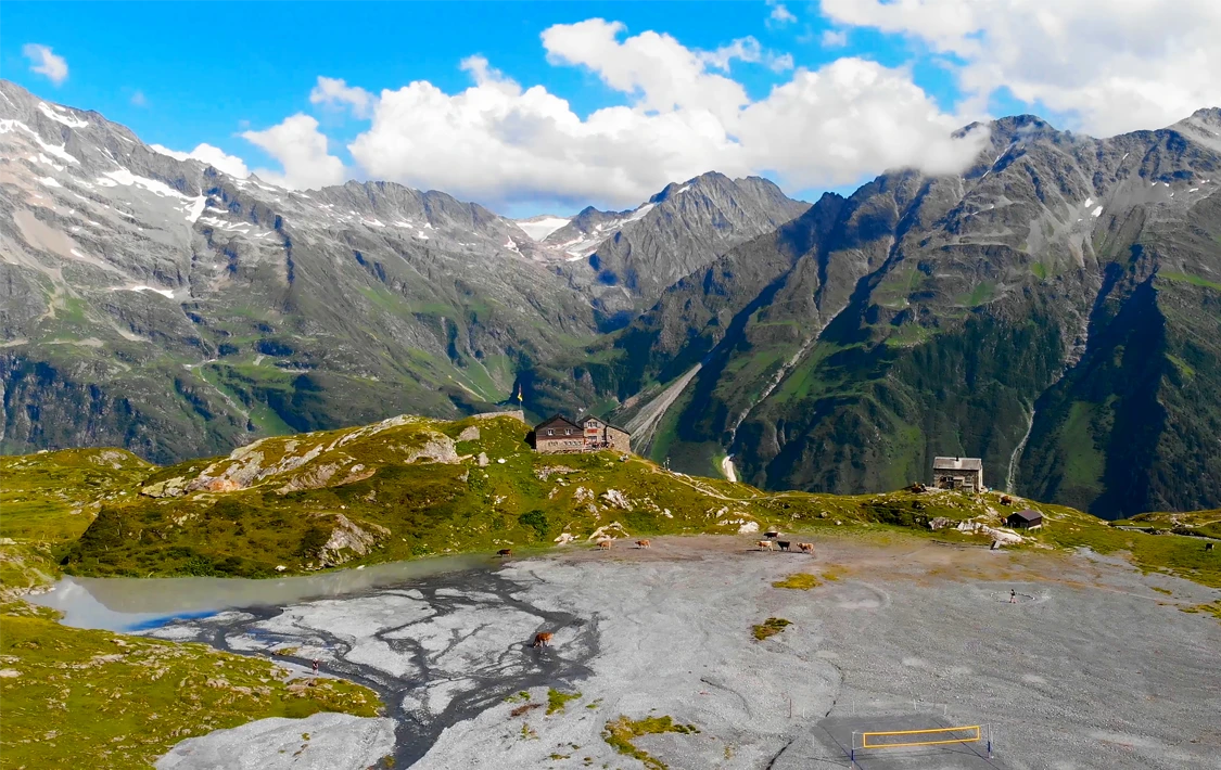


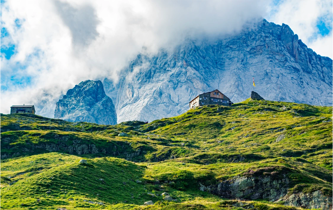

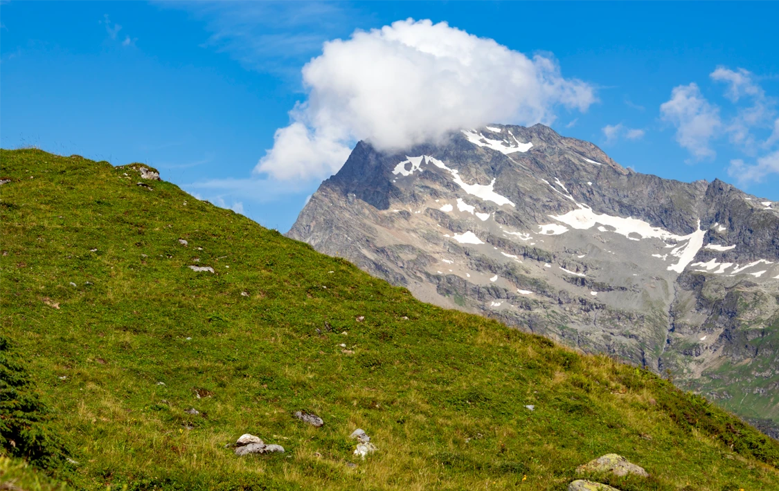
The hike continues from Lake Golzern (1,411 metres above sea level) to Windgällen Hut, located at 2,033 metres. The mountain hut lies approximately 3.5 kilometres from Lake Golzern and can be reached in around two hours.
During the ascent, you’ll cover roughly 690 metres of elevation gain. The trail leads over rocky and uneven terrain, but remains well signposted and relatively easy to follow. For inexperienced hikers, the climb can be physically demanding and sweaty, especially during summer. Nevertheless, the route is manageable for most people with an average fitness level.
Throughout the ascent, you’ll be accompanied by beautiful alpine flora, while looking back towards the deep blue waters of Lake Golzern below. After completing the climb, you can reward yourself at Windgällen Hut with a cold drink or a well-deserved snack. Take a seat on the sunny terrace and enjoy the spectacular mountain panorama surrounding you.
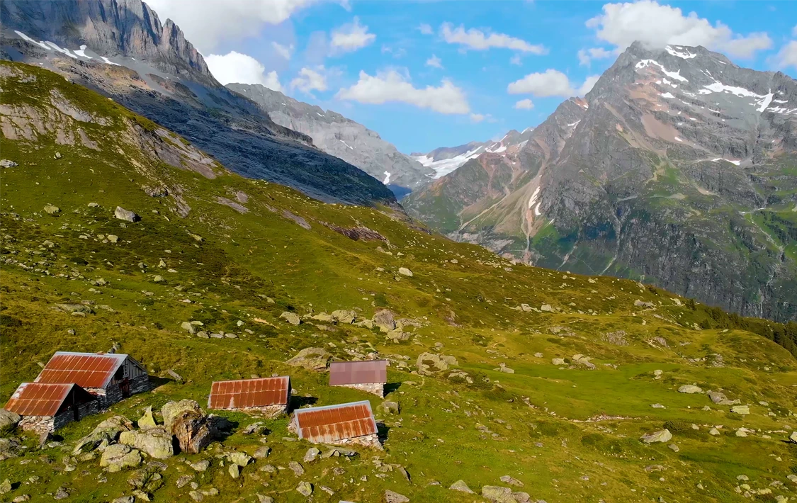
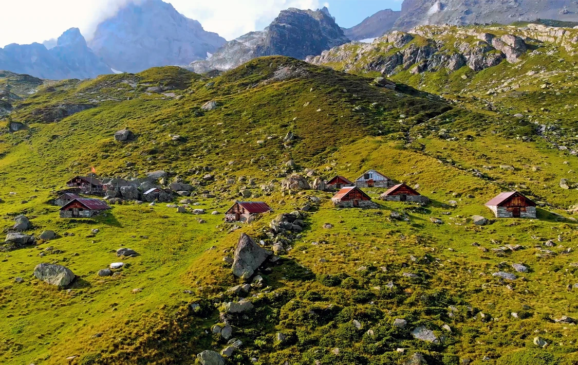
From here, peaks such as Gross Windgällen, Gross Ruchen, Gross Düssi and Oberalpstock remain constantly in view. Besides food and drinks, Windgällen Hut also offers overnight accommodation for hikers.
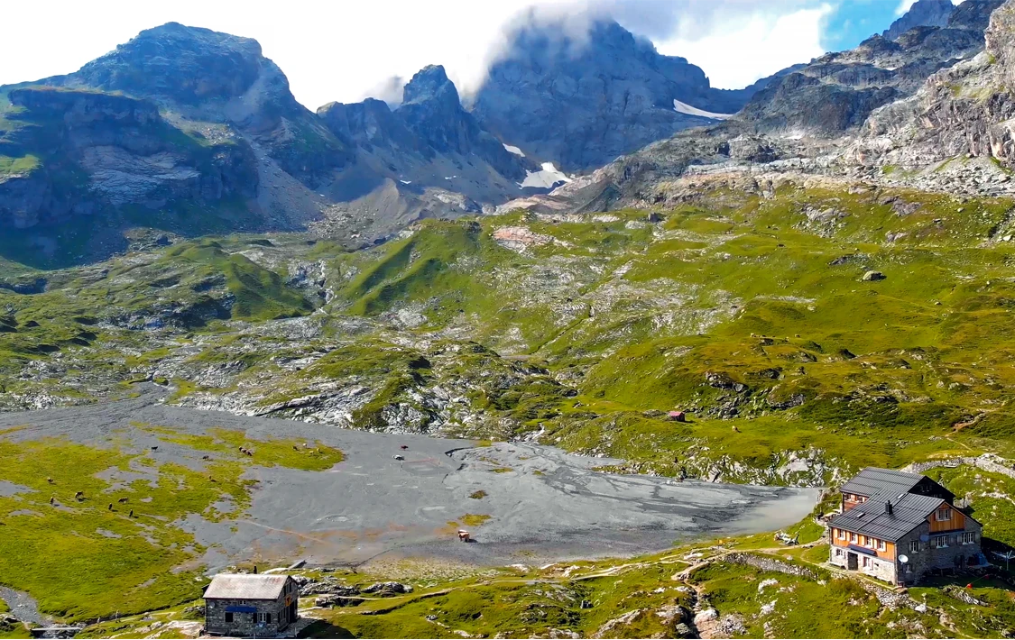
The surrounding rocky alpine plateau is dotted with waterfalls and mountain streams, eventually feeding into a small alpine pond. Surrounded by grazing cows and llamas during the summer months, visitors even have the opportunity to play volleyball on one of the highest volleyball courts in Switzerland.
The entire area is also popular among crystal hunters and mineral collectors, who search the mountains for rock crystals. Perhaps you’ll discover your own crystal?
After a break at the hut, the hiking trail continues across an alpine plateau towards Hotel Maderanertal, where the next section of the route begins.
Descent From the Alpine Plateau to Hotel Maderanertal
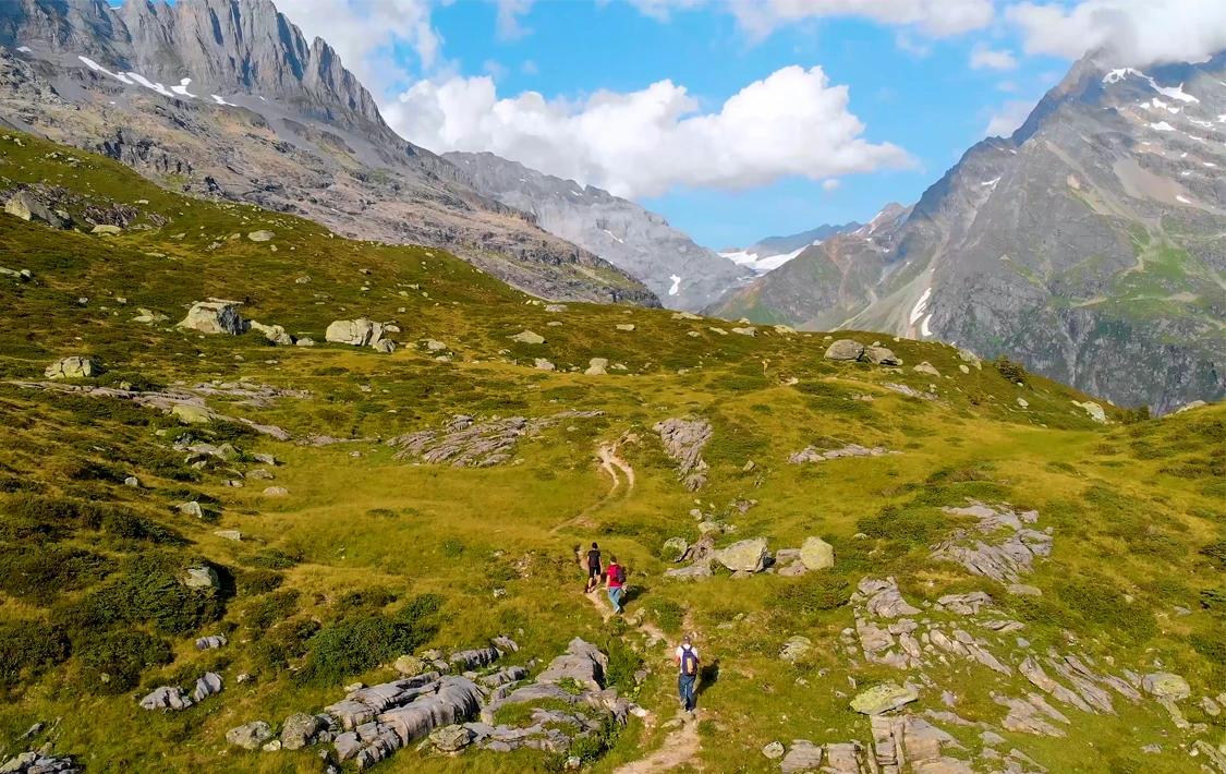

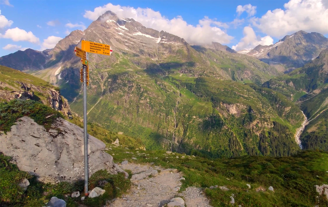

From Windgällen Hut, the trail leads across a beautiful alpine plateau towards Hotel Maderanertal.
The route passes through lush mountain scenery filled with colourful alpine flowers, alongside small streams, while constantly rewarding you with spectacular views of the surrounding Alps. Peaks such as Gross Düssi, Oberalpstock and Witenalpstock dominate the horizon throughout this section.
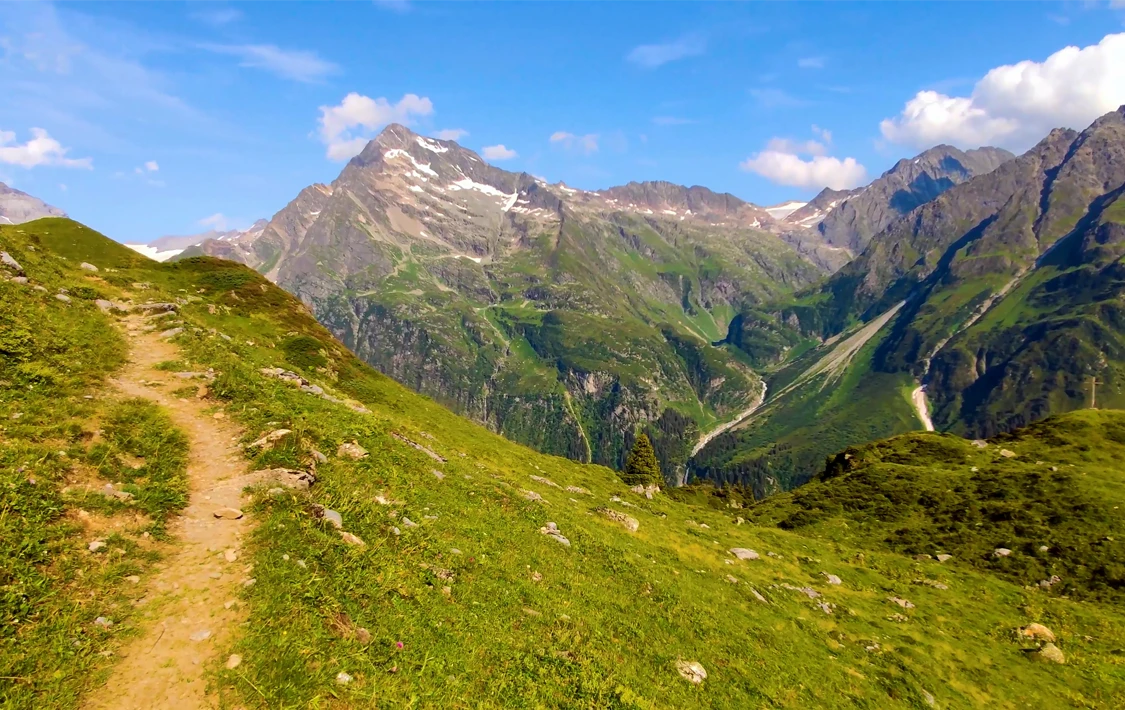
The gentle walk across the plateau takes around 30 minutes, before the actual descent towards Hotel Maderanertal begins. After the relatively easy section across the alpine plateau, the trail becomes noticeably more challenging.
The descent takes approximately 45 to 60 minutes and includes narrow and occasionally steep sections, making good hiking footwear highly recommended. From the plateau down to Hotel Maderanertal, you’ll descend almost 500 metres in elevation, which will certainly test your leg muscles.
Once you’ve completed the descent, the final section of the hike continues from Hotel Maderanertal back to Bristen valley station.
From Hotel Maderanertal Back to Bristen Valley Station
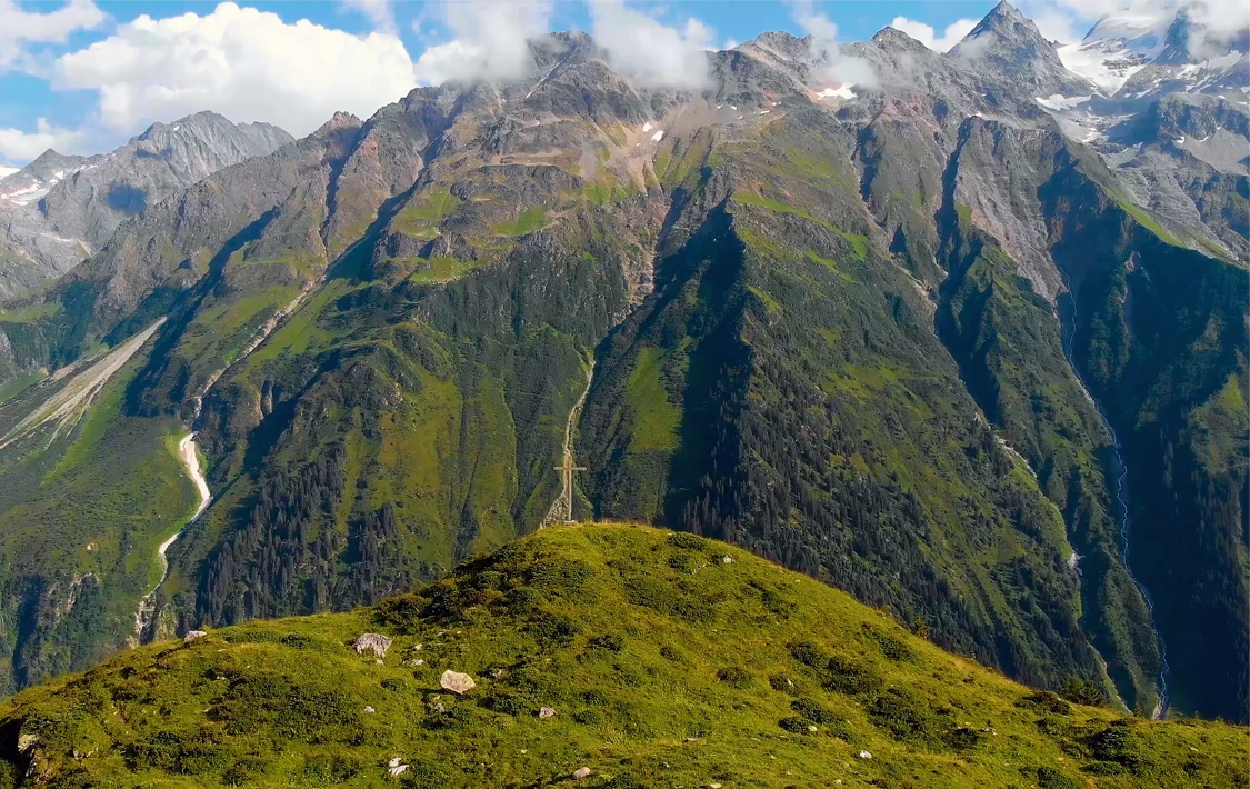
You’ve now completed the most challenging sections of the circular hike. Although the final part of the route includes another 500 metres of elevation change, these are spread over a distance of around 5.5 kilometres. As a result, the 1.5-hour walk back feels surprisingly manageable and not overly demanding.
The well-maintained hiking trail follows the rushing Kärstlenbach stream, leading through the wild and untouched landscape of Maderanertal. The valley is characterised by peaceful surroundings, dense forests and beautiful alpine nature.
Along the route, you’ll pass a handful of tiny mountain settlements, home to charming traditional wooden houses.
Eventually, the trail brings you back to Bristen valley station, the starting point of this Golzernsee hiking route.
Do You Have Questions About the Golzernsee Hiking Guide?

Are you planning a hike to Lake Golzern and still have questions about the route?
Or do you know other hiking trails around Lake Golzern that you’d like to share with our readers?
Then simply use the contact form below to get in touch.